
El Saltador Bajo – Archaeology, Natural Environment and Mining Traces
Accommodation in El Saltador Bajo
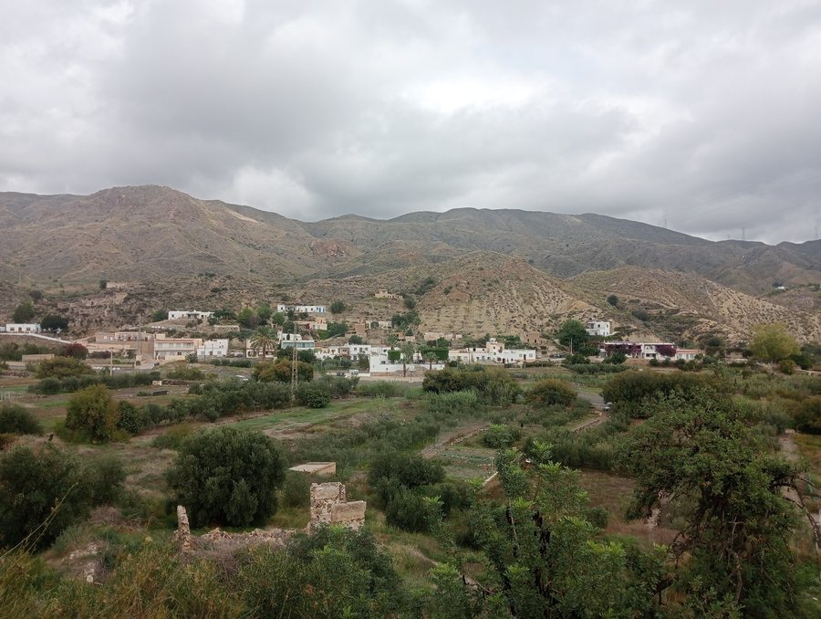
El Saltador Bajo is designated in Carboneras as an archaeological site from the Copper Age. The district of El Saltador Bajo lies on the left bank of the Rambla del Saltador. Among the districts of El Saltador, it is the most compact and has the greatest number of houses. Its location on the rambla connects the settlement core with the riverside areas and the surrounding landscapes.
Nature
The Rambla del Saltador belongs to the natural environment of the Cabo de Gata-Níjar Nature Park. El Saltador Bajo is one of the settlement cores designated within the zoning area of the Cabo de Gata-Níjar Nature Park. El Saltador Bajo is part of El Saltador, the northernmost settlement core of the Cabo de Gata-Níjar Nature Park. El Saltador lies in the foothills of the Sierra de Cabrera. Thus, the rambla, the protected area and the transition to the mountain region meet directly in the district.
Small springs once irrigated the cultivated areas on the right bank of the Rambla del Saltador. Many of these areas are now planted with olive trees. The two banks of the rambla are therefore associated with different uses: the district lies on one side, while the formerly irrigated cultivated areas, now partly characterized by olive trees, lie on the other.
History
Historical livelihoods in El Saltador included gathering esparto grass for the fiber industry. Agriculture, livestock farming and mining were also among these livelihoods. This list points to several areas of the locality’s history connected with the landscape and mining traces in the surrounding area.
In the vicinity of El Saltador, El Cumbrero is located on the Rambla del Saltador. The Las Juntas water mill is situated there and is also known as Molino de Beatriz Ruíz. The mill was formerly powered by water from a nearby spring, which was channelled to the mill wheel. Its location on the rambla and the former watercourse make the connection between waterways and historical use particularly clear.
In the immediate vicinity of El Saltador, the now-abandoned Peñas Negras mine lies on the Barranco del Arto. Ruins of several facilities and the tunnel entrances are visible there.
In the immediate vicinity of the Peñas Negras mine, there are limonite and hematite outcrops in Triassic limestone. Some ruins of the mining facilities are visible from the barranco, while access to the extraction areas is via a steep ascent. The visible ruins and the geological outcrops therefore belong to different traces of the same mining environment.
Orientation
The AL-6112 road provides direct access to the western part of El Saltador Bajo. El Saltador can be reached directly from Carboneras via the AL-5105 road. The two road references distinguish access to the district from the route connecting Carboneras with El Saltador.
A main road accessible to motor traffic in El Saltador Bajo runs from west to east. The main road leads to Plaza Tierno Galván. The local doctor’s surgery is located at Plaza Tierno Galván. Sports and children’s play areas by the rambla can be reached via a staircase. The points mentioned are therefore distributed between the main road, the square and the area by the rambla.
Further destinations
Further destinations: Taberno, Antas, Canjáyar, Gérgal, Mojácar, María, Guazamara and Balerma.
Hiking and Festivals
A hiking trail described as a draft has been documented for El Saltador Bajo. A hiking route through a hunting area requires particular caution during the hunting season. Local festivities are celebrated in El Saltador at the end of August.
For the overarching travel overview: Almeria.

