
Landscapes in Andalusia: Discover the coast, mountains and rivers
Andalusia cannot be reduced to beaches and white villages. The Atlantic, Mediterranean, river plains, arid landscapes and mountains all lie relatively close together within the region, yet feel very different depending on the season and route. So when planning a trip, start by asking what matters most: beach time, cities and culture, hiking, or a varied road trip?
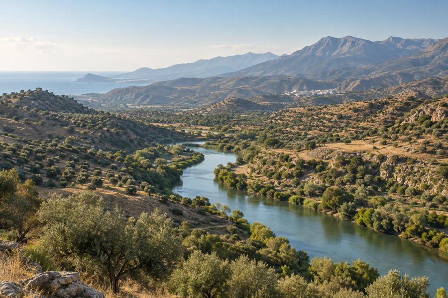 AI-Symbolbild: Fluss, mediterrane Hügel und Berge als atmosphärische Darstellung verschiedener Landschaftsräume Andalusiens; kein bestimmter Ort.
Photo: KI-generiert für Max-TD
AI-Symbolbild: Fluss, mediterrane Hügel und Berge als atmosphärische Darstellung verschiedener Landschaftsräume Andalusiens; kein bestimmter Ort.
Photo: KI-generiert für Max-TD
Comparing the landscapes can help you choose accommodation, daily distances and the best time to travel. The Atlantic coast with its winds, a sheltered Mediterranean cove, the heights of the Sierra Nevada and the Guadalquivir lowlands are separated not only by distance, but also by marked differences in temperature, travel time and activities.
Quick facts
- The Costa de la Luz on the Atlantic often feels more open and windier than the more built-up Mediterranean coast.
- The Costa del Sol combines beaches, cities and a well-developed tourist infrastructure.
- The Sierra Nevada and Sierra Morena offer mountain scenery with different elevations, temperatures and vegetation.
- The Guadalquivir shapes the cities, agriculture and wetlands of western Andalusia.
- Cabo de Gata is known for its arid volcanic landscapes and coves along the coast of Almería.
- A road trip is more relaxing if you avoid switching between the coast, mountains and cities every day.
Atlantic or Mediterranean?
The Costa de la Luz is a good choice for long beaches, dunes, wind and towns such as Tarifa, Rota or Ayamonte. On the Atlantic, wind and waves can have a greater impact on a day at the beach, so it is worth planning alternative destinations if you are hoping for calm swimming conditions.
The Costa del Sol is more built-up and suits travellers who want to combine beach days with visits to Málaga, Marbella or Nerja. The specific location of your accommodation, transport links and whether you prefer peaceful nature or easy access to restaurants and attractions are all important factors.
Mountains, gorges and protected areas
The Sierra Nevada near Granada offers high-mountain scenery where conditions can change rapidly. In the Sierra de Grazalema, rocks, gorges and white villages shape the route; the Sierra Morena is more forested and tranquil. In the southeast, Cabo de Gata offers arid volcanic slopes, coves and a completely different palette of colours.
For hiking, cycling or visiting viewpoints, take temperature, shade and water into account, and make a realistic assessment of the route. Protected areas also require respect for paths, wildlife and access roads. For information about natural areas and regional offerings, visit Andalusia’s official nature information.
The Guadalquivir and the western lowlands
The Guadalquivir connects the inland region with cities such as Seville and shapes the fertile plains farther west. Its surroundings are a good fit for travellers who want to combine culture, agriculture and river landscapes. Near the river mouth, the scenery changes to marshland and dunes around Doñana.
For a route like this, it is worth separating city visits from nature outings. You can visit natural attractions early in the day and head into the city later; in hot weather, shade, water and a flexible schedule matter more than trying to fit in as many stops as possible.
White villages and changing landscapes
Between the coast and the mountains are places where the transition from plain to hill country is especially striking. Arcos de la Frontera, Mijas and Antequera make interesting stopovers, each offering something different. The Route of the White Villages connects several towns, but should not be treated as a single fast route.
Check parking options, elevation changes and the time needed for walks in advance. Historic town centres are not always easy to reach with luggage. If you want to spend less time driving, choose one base and add a few individual day trips.
When to travel and routes to suit
For a beach holiday, coastal location, water temperature and wind are key; spring and autumn are often more pleasant for cities and many hikes. In summer, the coast offers a welcome break from the heat inland, while weather and temperatures can change quickly at higher elevations.
A first road trip could combine a city, a coastal base and an excursion inland. If you have more time, add either mountains or a river landscape rather than changing locations every day. For arrivals and onward travel, see airports in Andalusia and getting around Andalusia.
FAQ about Andalusia’s landscapes
Which landscape is best for a first trip to Andalusia?
Combining a city, a coastal base and an excursion inland offers plenty of variety without too many changes of location. For additional nature experiences, you can choose either a mountain range or a protected area.
Can you combine the coast and Sierra Nevada in one week?
Yes, with a clear route and only a few places to stay. Allow realistic driving times and avoid planning a new destination every day. Depending on which stretch of coast you choose, Granada can serve as a link between the city, mountains and other destinations.
Is the Costa de la Luz always windy?
Wind is part of the character of the Atlantic coast, but its strength and direction vary. For a beach day or watersports, current conditions matter more than any general rule.
Which landscape is more comfortable in summer?
The heat is often easier to bear on the coast than inland. Shade and elevation can help in the mountains, but you should still check the weather, water availability and trail conditions before every outing.
How many places should a road trip include?
A trip is usually more relaxing with fewer fixed bases. Depending on the length of your stay, two to four bases may be enough, especially if you can take day trips from them to the coast, mountains or cities.
Do I need to make special preparations for natural areas?
For easy walks, suitable shoes, water and a quick check of the weather and access routes are usually enough. For longer or more remote routes, also check the distance, elevation gain, shade and options for getting back.
